 |

|
|
|

|
|||
The Mayfield Cemetery is owned and operated by
The Rural Municipality Chesterfield No. 261, Saskatchewan.
The R.M. on Wikipedia
The Rural Municipality Chesterfield No. 261, Saskatchewan.
The R.M. on Wikipedia
| GPS Coordinates: 51.06644, -109.98641 | |
|---|---|
| NE-21-24-29-W3 R.M. of Chesterfield No. 261 |
|
| Google Maps Android Phone |
Apple Maps iPhone link |
| what3words ///holding.demands.deluxe |
OpenStreetMap |
Find a Grave®: Mayfield Cemetery
Maps & Directories
| Simple Map | Official Map |
|---|---|
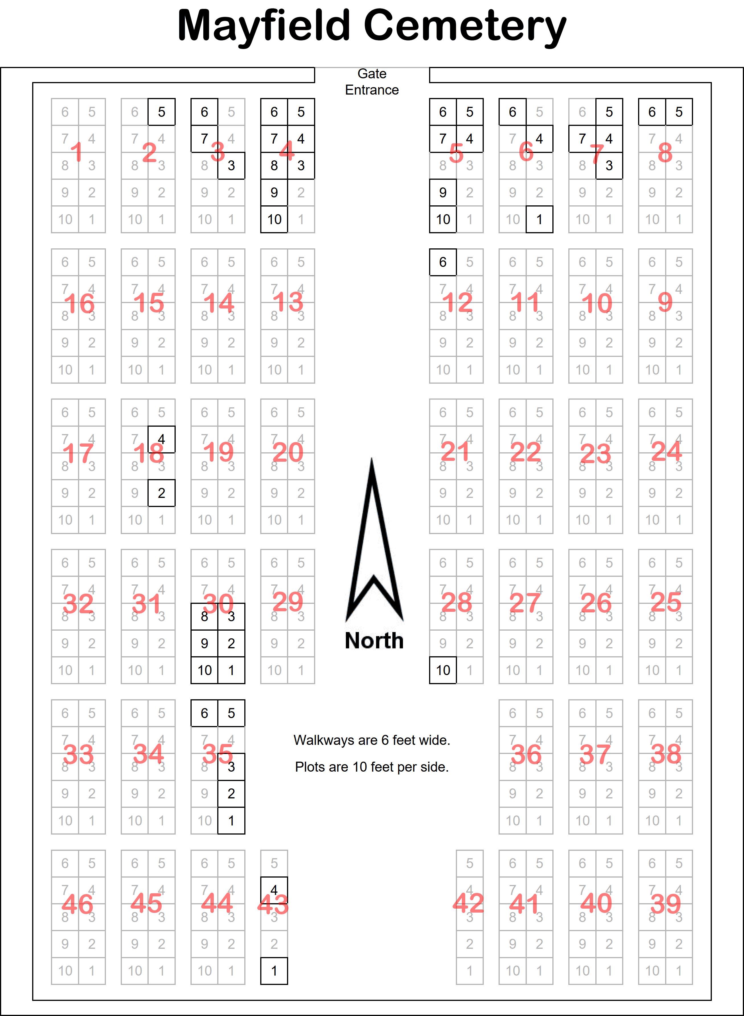 |
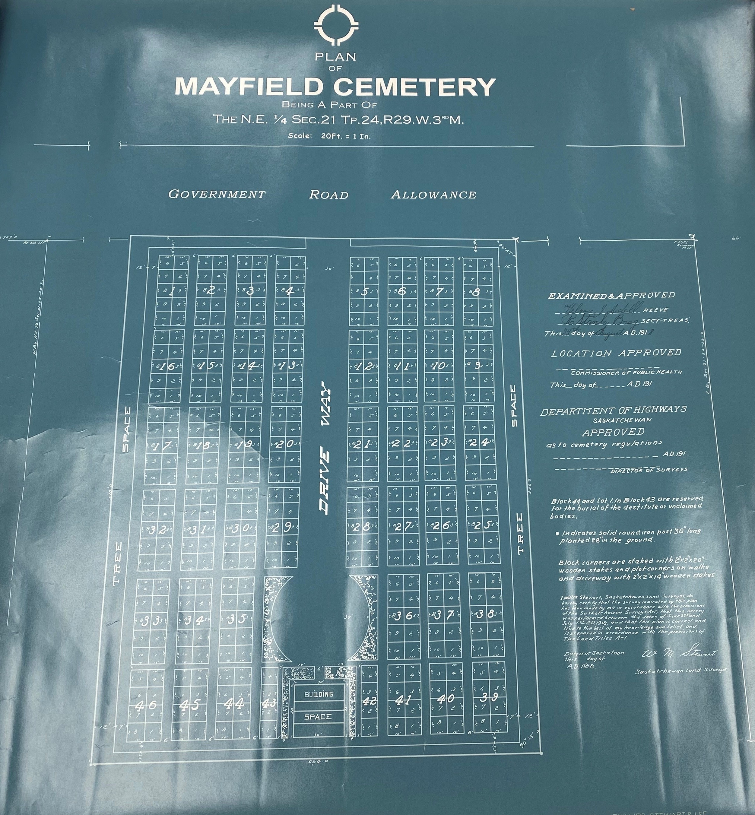 |
| These are PDF files with clickable links. | |||
| Item | Release Date | Pages | Page Size |
|---|---|---|---|
| Detail Map | 2026-May-10 | 1 | 115 x 162.5 cm |
| Full Directory | 2026-May-10 | 3 | 72.27 x 27.94 cm |
| Basic Directory | 2026-May-10 | 2 | Letter (21.59 x 27.94 cm) |
| The Full Directory and the Big Map contain links that lead to individual Bio pages for each person when I have done some research on them and their family. I will add more as my research continues. | |||
Other Links
| The Bruce's Graveyards group of websites are not monatized, meaning I do not make any money from these websites. There are no advertisements. Bruce A. Johnson - Empress, Alberta, Canada |
Do you have any corrections, concerns, questions, or comments? I'd happy to discuss them. |